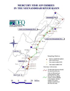
This map, produced for the Shenandoah River Basin, shows mercury fish-consumption advisories and sampling stations along the Shenandoah and its forks. Legends identify stations sampled throughout the study, new stations added in 1999 and 2001, and advisory zones where only trout or limited fish meals are recommended for sensitive populations. Virginia Department of Environmental Quality logo appears.
File Type:
pdf
Categories:
Maps
Publication Date :
Type :
Map
Review Notes :
No publication date or author is visible on the map. The legend indicates new sampling stations added in 1999 and 2001. Small station identifiers are present on the map but are not fully legible at the provided resolution.