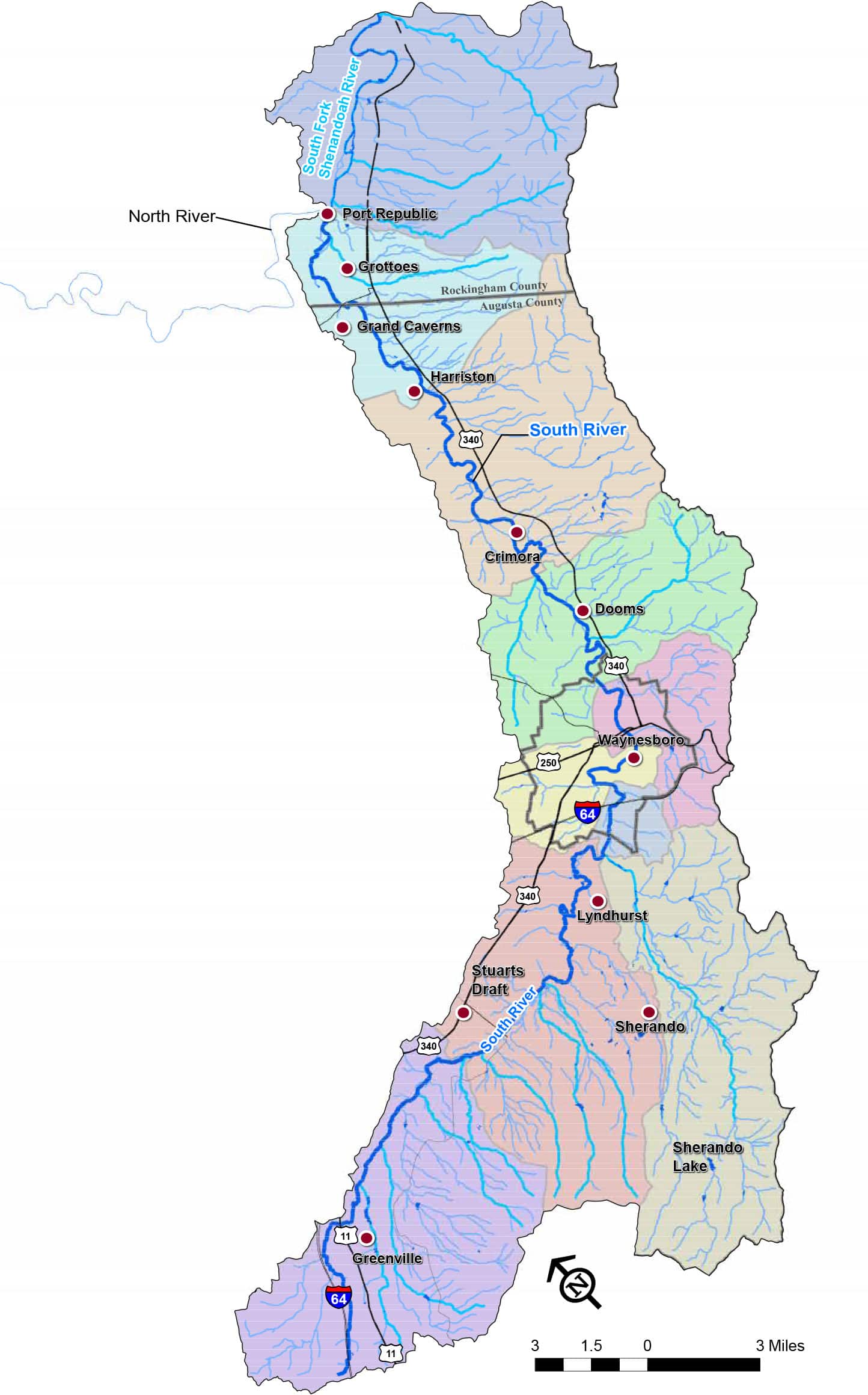
From Greenville in southeastern Augusta County to Grottoes in northeastern Augusta County, our South River flows north in Augusta County to join Virginia’s South Fork of the Shenandoah River. Fed by headwater trout streams in the national forest and springs in the Valley’s rich farmlands, our South River is a valuable natural and recreational resource. The South River watershed includes the communities of Waynesboro, Stuarts Draft, Crimora and several other towns and villages that rely on the river as a water supply for their citizens and industries. Shenandoah National Park, Sherando Lake, Grand Caverns, and many other public parks provide abundant outdoor recreational opportunities throughout our watershed. For maps of the South River and its watershed, explore our Map Resources below.
What is a Watershed?
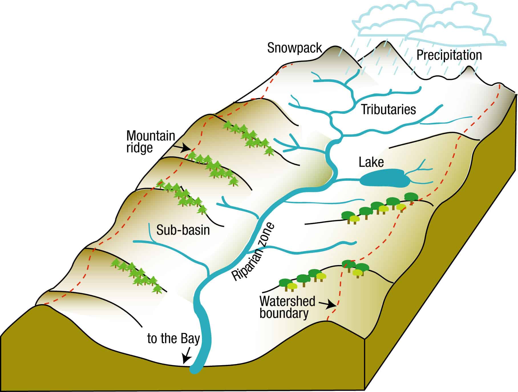
The watershed is every piece of land through which water flows toward a central water body.
For instance, the continental divide is North America’s most famous watershed boundary. On the east side of the continental divide, the rivers and other water bodies all drain to the Atlantic Ocean. On the west side of the continental divide, all of the waters drain to the Pacific Ocean.
In our case, creeks and streams from this part of the Shenandoah Valley move water into the South River.
No matter your proximity to the South River, the level of care for the land and water in each community affects the downstream neighbors. That’s how a watershed connects us together — through the land and water.
How do I find my watershed?
The South River watershed includes the mountains and hills surrounding the river. Check out this map to see the extent of the South River Watershed.
Map Resources
| Title | Categories | Link | hf:doc_categories |
|---|---|---|---|
| Waynesboro Watertrail Brochure | Maps | maps | |
| South River Watershed Map | Maps | maps |