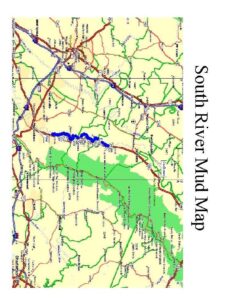
Single-page map titled "South River Mud Map" showing a highlighted reach of the South River with mapped mud or sediment deposits. The map includes regional roads, waterways, and green shaded land areas, with the river corridor marked in blue. This appears to be a visual overview of mud distribution along the river.
File Type:
pdf
Categories:
Maps
Publication Date :
Type :
Map
Review Notes :
No publication date or author is visible on the single-page image. The map shows roads and place names but the resolution prevents firm identification of specific towns; location inference beyond the visible 'South River' label was avoided.